Atmospheric rivers can cause catastrophic flooding and landslides but are crucial for water supply. In an era of increasing weather whiplash between flood and drought, can we learn to embrace the rains?
By Serena Renner
In mid-November 2021, a great storm begins brewing in the central Pacific Ocean north of Hawai‘i. Especially warm water, heated by the sun, steams off the sea surface and funnels into the sky.
A tendril of this floating moisture sweeps eastward across the ocean. It rides the winds for a day until it reaches the coasts of British Columbia and Washington State. There, the storm hits air turbulence, which pushes it into position—straight over British Columbia’s Fraser River valley.
Clouds gather and darken. Below, a patchwork of farms and subdivisions sprawls along the Fraser River from its mouth, south of Vancouver, to the eastward mountain slopes, and southeast across the US border. At the center of the valley lies Abbotsford, a city of around 150,000 people nestled in a fingerprint-like depression between two mountains. As the stream of humid air rises toward the peaks, it cools, condenses, and bursts.
To Murray Ned, it sounds like a creek is overflowing outside his home in Kilgard, on a hillside within Abbotsford that’s part of the Semá:th (Sumas) First Nation reserve. Lying in bed, Ned listens to water overflow his rain gutters and splash two stories to the ground. Rain is common in Abbotsford in November, but it’s usually quiet. And it usually lets up.

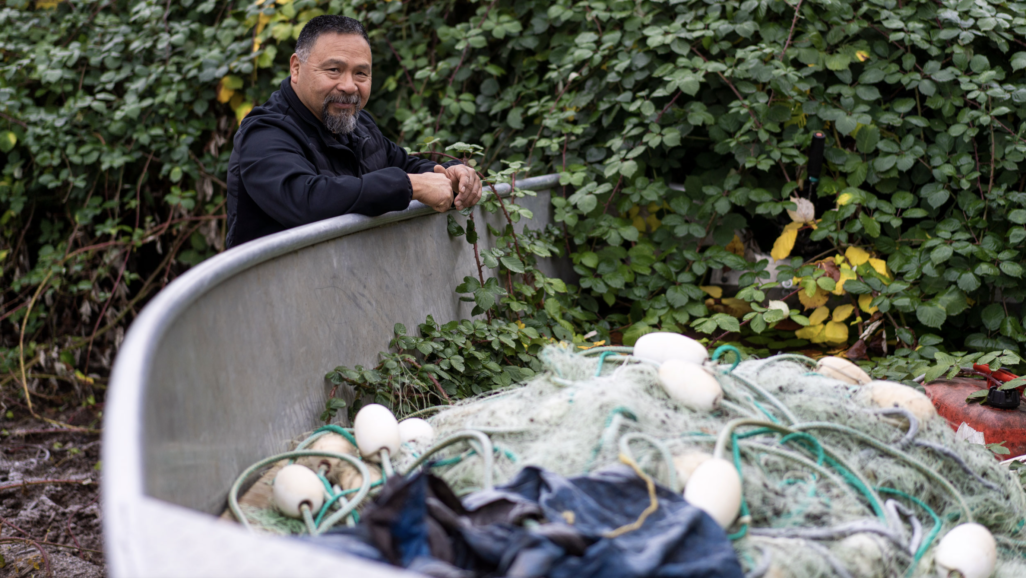
Murray Ned stands at the edge of his backyard in Abbotsford, British Columbia, which was transformed into a boat launch following an unprecedented atmospheric river storm that dropped 172 millimeters of rain between November 13 and 15, 2021. Photo by Jimmy Jeong
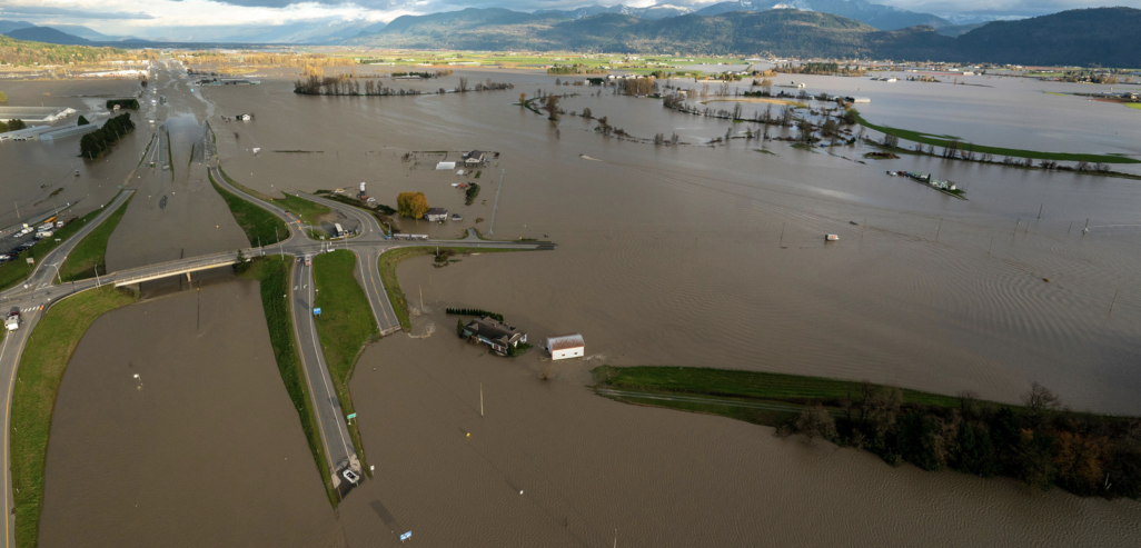
Over the next two days, nearly a month’s worth of rain dumps here and in other parts of the province. The resulting floods and landslides kill at least six people, rip apart buildings, and buckle roads. In Abbotsford, more than 1,000 homes are swamped and 640,000 farm animals perish as rivers reclaim agricultural land in the floodplain.
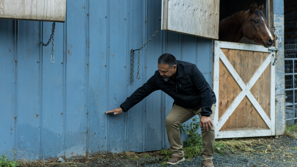
But amid the losses, Ned sees something else. The Tuesday evening of the flood—after he has vacuumed water from his mother’s basement and moved the family’s horses to high ground—the deluge stops. Ned settles into a folding chair in his backyard, pulls out a Kokanee lager, and takes in the view. The flood laps knee-high against his horse barn. Semá:th Xó:tsa, Sumas Lake, has returned to the territory.
Once a 6,475-hectare body of water, Sumas Lake brimmed with sturgeon, trout, and five species of salmon—sustaining the Semá:th people and larger Stó:lō Nation for millennia. The lake swelled with fall rains and spring snowmelt, and shrank during summer, leaving fertile ground between the high and low water marks where wild potatoes, berries, and blue camas flowers with edible bulbs thrived. By 1924, though, settlers had converted the lakebed into permanent farmland with a system of dikes, canals, and pumps. But after the 2021 storm, everything in the lowlands is submerged again, from cornfields to the Trans-Canada Highway to a castle-themed fun park.

Ned shows how high the floodwaters rose around his horse barn after the mid-November 2021 atmospheric river rainstorm. Photo by Jimmy Jeong
Most of the floodwaters have come from the Nooksack River. High runoff shifted the Nooksack’s course from its usual east–west flow in the United States and sent it rushing northward into Canada. Stó:lō elders know it can do this. For most of the postglacial period, before natural sedimentation deflected its course, the Nooksack fed the Sumas and Fraser Rivers as well as Sumas Lake. Big floods today can still send the river back north, borders be damned. Water was made to change states. Not so long ago, Sumas Lake had been there to catch it.
As Ned surveys the moonlit water, glistening around horse barns, poultry sheds, and power lines, sturgeon and coho salmon swim old migration routes beneath the surface. “To see Mother Nature threaten [the region] but also see the lake in all its glory again was pretty amazing,” Ned tells me later. Alongside the lake, he sees the possibility of a different future: one that restores space and flexibility for water and that keeps communities safer from the extremes of climate change.
The storm that hit Abbotsford is known as an atmospheric river. These systems are common along the west coast of North America and midlatitudes around the world. They account for one-third to one-half of the annual precipitation in some areas and represent a major source of fresh water for many countries. But studies suggest that atmospheric rivers are becoming more volatile and are delivering water in bigger bursts. Paradoxically, recent storms, including the one in British Columbia, have occurred between some of the hottest and driest summers on record. When they deliver needed rain, it’s too much for parched soils and concrete channels to contain. This pendulum swing between deluge and drought—what meteorologists have started calling “weather whiplash”—will only grow more pronounced as the planet warms.
Ned and other members of Semá:th First Nation have begun advocating to revive at least part of Sumas Lake for the ecosystem and Stó:lō culture, and also for flood control and natural water storage that will make the region more resilient against future disasters. So far, they haven’t gained much traction in Abbotsford, but efforts elsewhere suggest they’re onto something. Perhaps nowhere provides more examples than California, which has long ridden the seesaw between dangerous downpour and punishing drought. Whether through foresight or surrender, communities there are giving up new ground for water and restoring some natural systems, to work with rain when it comes.
Read the full feature, published July 18 2023, in Hakai Magazine. Or listen to me narrate it on the Hakai Magazine Audio Edition.